3 Ways Geospatial Technology Can Improve Our Lives
3 Ways Geospatial Technology Can Improve Our Lives
Insight MinLaw goes behind the scenes to uncover stories about how the work we do impacts you.
Ever heard of geospatial technology? It is a term referring to tools, including the global positioning system (GPS), which collect and analyse location-based data so that we can better understand our surroundings.
For instance, are you the type of person who pulls up a map to plan your route before travelling to somewhere unfamiliar? If so, you may also want to know where the ramps and pedestrian crossings are for ease of travel if you have your baby in a stroller, or move about using a Mobility Aid. Here is where geospatial technology can make a difference.
Did you know that barrier-free access (BFA) routes are now available on Singapore’s national authoritative map, OneMap, and this is made possible by tapping on geospatial technology?
Besides bringing greater convenience to our commutes, geospatial technology can even be used to boost your health and social wellbeing by directing you to relevant resources. The Singapore Geospatial Master Plan (2024 – 2033) seeks to harness the potential of location-based technology and data powered by real-time high-precision positioning to meet society’s evolving needs.
Here are three ways how geospatial technology can improve our lives.

SLA capturing and mapping geospatial information
1. Mapping Paths to Inclusive Communities
In the past, wheelchair user Ms Judy Wee found it necessary to ask friends or do a precheck to find out whether a place was wheelchair accessible. She found that sometimes, even upon arrival, locating ramps was difficult.
"With OneMap, it highlights the barrier-free routes and makes it more convenient for users to navigate around," Ms Wee, the Executive Director of Muscular Dystrophy Association, shared.

Ms Judy Wee using the barrier-free access route feature on OneMap
In a collaboration with SG Enable and Gardens by the Bay, Singapore Land Authority (SLA) introduced a pilot app to develop the BFA function on OneMap, to help wheelchair users navigate around more easily by providing an additional routing option that includes covered linkways, ramps, footpaths, pedestrian crossings, and overhead bridges with lifts.
Over 100 wheelchair users tested the BFA function on the pilot app across four sessions, in locations including Gardens by the Bay, Orchard Road, Ang Mo Kio and Bukit Merah. SLA collected information on the data landscape and coded the algorithm to enable wheelchair users to have a safe and smooth journey on the walking paths. Based on the feedback gathered, SLA then integrated the solutions onto the BFA routing feature on the OneMap app, which was eventually launched for public access on 6 March 2024.
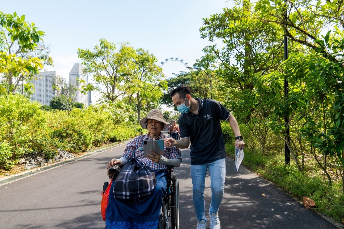
SLA staff assisting a wheelchair user during the pilot testing session at Gardens by the Bay
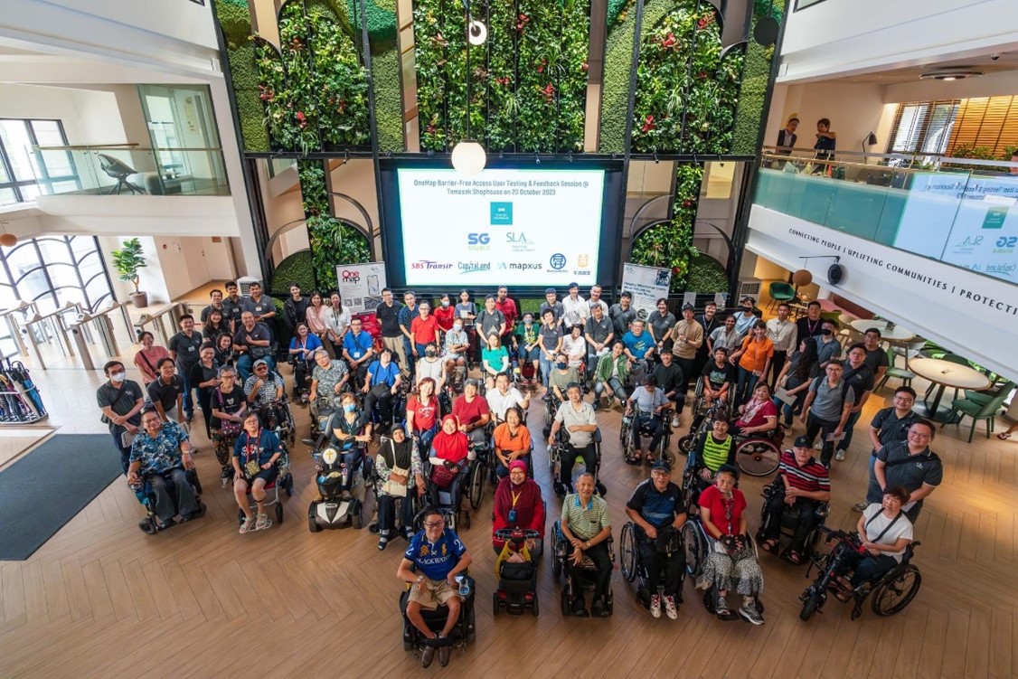
About 80 volunteers comprising wheelchair users, facilitators and guests participated in the final BFA pilot testing session at Orchard Road, which started at Temasek Shophouse

Moving forward, SLA and SBS Transit are working together to create more barrier-free routes around public transport areas. SLA’s Senior Manager of Geospatial Systems & Technology, Andy Tan, shared that SLA is also expanding the BFA function to include interior navigation of buildings. “In addition, the upcoming iOS version will enable more users to access the BFA function,” he added.
2. Pioneering Preventive Healthcare for a Healthier Future
Social prescribing is an innovative model of care that goes beyond medical solutions and takes into account social determinants of health, with a view towards fostering better health and well-being outcomes for individuals. Social determinants of health are conditions in the environments where people are born, live, learn, work, play and age that affect a wide range of health and quality-of-life outcomes.
Wellbeing coordinators (WBCs), the integral workforce behind SingHealth Community Hospitals’ (SCH) social prescribing efforts, collaborate with both patients and multi-disciplinary clinical teams to co-develop personalised social prescriptions, which aim to link the patients to an asset in the community – be it an active ageing centre, an activity with the resident’s network or a person, or a community group active in a specific, meaningful social activity.
The Living Asset Map, a collaboration between SLA and SCH, aims to enable social prescribing by building a dynamic asset mapping methodology that best leverages geospatial technology to capture information that has been crowdsourced through community walks. It seeks to connect patients to a range of community assets to improve their health and well-being. These include community groups that forge social connections, activity-based groups that promote health-social integration and volunteer groups to engage seniors purposefully.
The Living Asset Map was awarded the ESRI GeoInnovation Award 2024, for innovative geospatial solutions in preventive healthcare delivery. The design of the Living Asset Map encompasses three main parts. Firstly, a data collection tool to allow those in the controlled crowdsourcing group to capture information such as location, time of programme and images. Secondly, a data management tool to enable these data to be verified. Lastly, a web map that practitioners of social prescribing can use to connect their patients with the relevant community assets as part of their personalised social prescriptions.
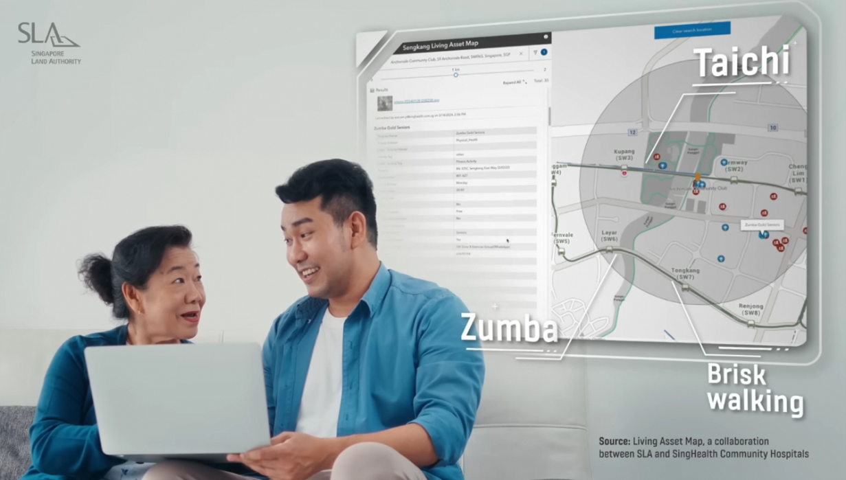
The Living Asset Map enables social prescribing
Megan Ann Pang, who was then the Geospatial Manager of Geospatial Planning & Services at SLA working on the project said: “SLA built the Living Asset Map in an iterative manner and engaged SingHealth Community Hospitals throughout the process. SLA conducted several rounds of user testing to obtain feedback to finetune the solution and methodology with each iteration”.
3. Navigating Health and Social Services with Ease
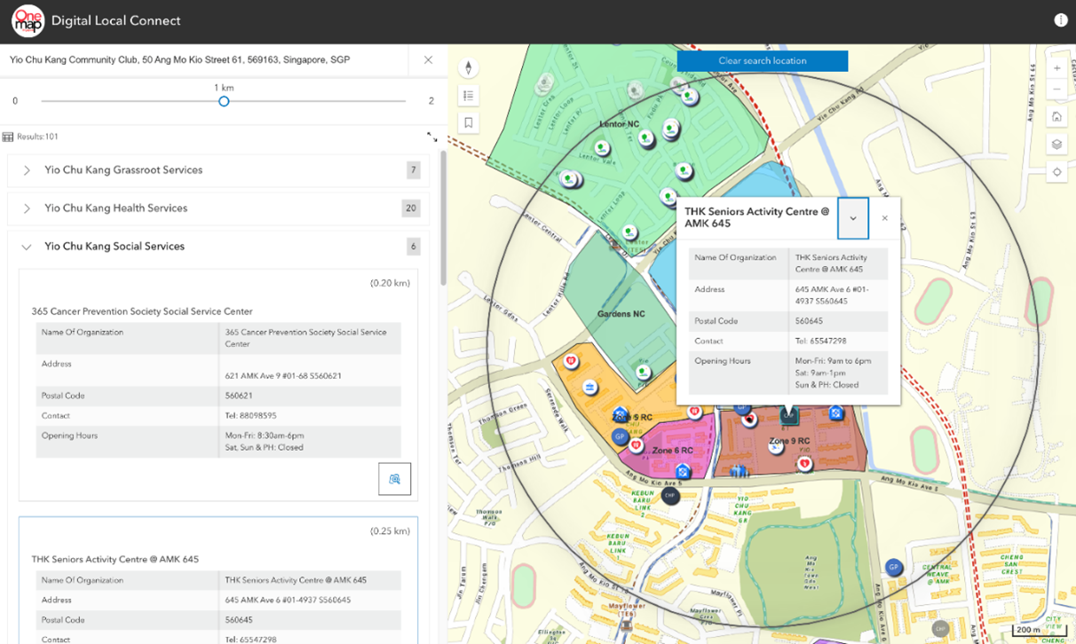
Screenshot from the Digital Local Connect platform showing health and social services around Ang Mo Kio
Credits: Courtesy of MOH Office for Healthcare Transformation
In line with the Healthier SG movement, SLA is collaborating with MOH Office for Healthcare Transformation (MOHT) on Digital Local Connect (DLC), an innovative digital platform that serves as a comprehensive ‘pocket guide resource library,’ for community partners and grassroots volunteers to direct residents to information about local health and social services. Whether it is finding key healthcare services such as GPs or dental clinics, or locating support services nearby, DLC allows users to easily identify and access these essential resources.
Yio Chu Kang was the first precinct on the island to roll out a localised version of DLC. The DLC is expected to be progressively rolled out to other precincts to enhance existing care and support for residents. This initiative aligns with SLA’s efforts to mainstream geospatial capabilities in sectors such as healthcare to promote inclusivity, preventive healthcare, and innovation.
Embracing Geospatial Technologies in Everyday Lives
The Geospatial Master Plan (2024 – 2033) envisions a transformative future where healthcare is seamlessly integrated into our daily lives and navigation is easy for everyone. SLA continues to push the boundaries of geospatial data and technology, paving the way for a healthier, more inclusive and more connected society.
Last updated on 26 Sept 2024
Other stories you may like:
Will LegalTech replace lawyers?
Getting to the Heart of Community Conflicts

